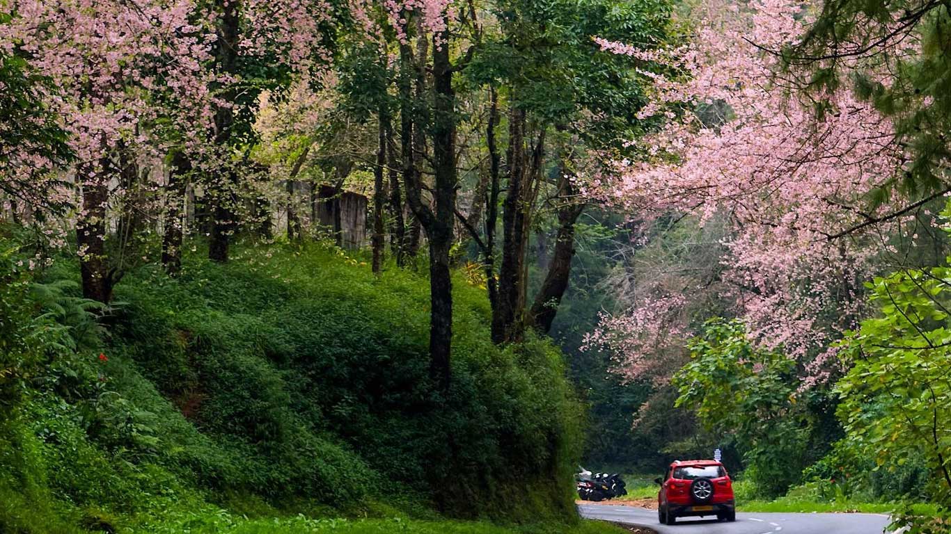
Shillong is a pleasant 3-hour ride from Guwahati and as the hill town approaches, nature seems to put on its best face. All along the road, tall and lanky betelnut trees sway in the breeze and vantage points look on to scenic rolling hills. With a momo stoop at Umiam Lake and the slight intoxication from the betelnuts, the excitement continues. As you get near Shillong, the mercury drops dramatically – by as much as 10 degrees in summer – and the entire hilly drive seems doubly worthwhile.
Generations ago, these hills must have extended a similar welcome to the British, reminding them of their wet and cool homeland. The beginning of what would often be called the ‘Scotland of the East’ go back to 1962-64, when the British obtained two large plots in the Khasi Hills. The agreement that saw the growth of Shillong, among India’s most prized hill stations and a district headquarters, was extracted from Mylliem, one of the 25 Khasi states ruled by elected rajas. And as David Scott, Assam’s Commissioner who laid the foundations of British rule in North-East India, famously told his friends, he settled here to ‘eat the Europe air’.
Contemporary Shillong is a small town, yet the only place close to a city in the North East with its English-speaking, church-going, guitar-and-piano-playing population, its restaurants and tourist infrastructure. Shillong is where they’ve been celebrating Bob Dylan’s birthday for years. Here, jam session proliferates and middle-aged government employees belong to bands. Ask around and you are likely to find a music concert.
But Shillong is also a good place to get introduced to the idea of cultural difference. Khasis, the main community in the region around Shillong, is a matriarchal society and you can see the evidence all around you. Khasi women are the carriers of the family name and property. Whether dressed in the latest Capri-pants or traditional jain-sayems, they are visibly the more confident of the two genders.
Finally, Shillong is the base for visiting textbook-famous Cherrapunjee, where the sign ‘ the rainiest place on planet Earth’ greets you/ This is a land of thick rainforests and pretty mist and green, green and more green.
Upper Shillong
Shillong was planned for the resident and itinerant Englishman. The authorities established their cantonment mostly in Upper Shillong, and in the remaining portion of this flat land, the civil station was laid out. European pensioners, officers, tea planters, businessmen – all built cottages naming them after places in England: Stratmore, now the BK Bajoria School; Bonny Brae, housing the Survey of India today; Crow borough, where a hotel is coming up
Indian Heritage Manors
The station gradually extended itself beyond the limits of British Shillong. Both Europeans and Indians began to buy land and build houses. Indian princely families started their establishments: Tripura, Chakhari, Manipur and even Nepal built imposing houses. Mayurbhanj Housebuilt by the Mayurbhanj princely family is now the property of the North-Eastern Hill University ( NEHU). Tripura Castle is a heritage hotel now.
Also check out Raj Bhavan, the old Government House. It’s not open to the public but makes worthwhile viewing from outside.
Umiam Lake or Barapani
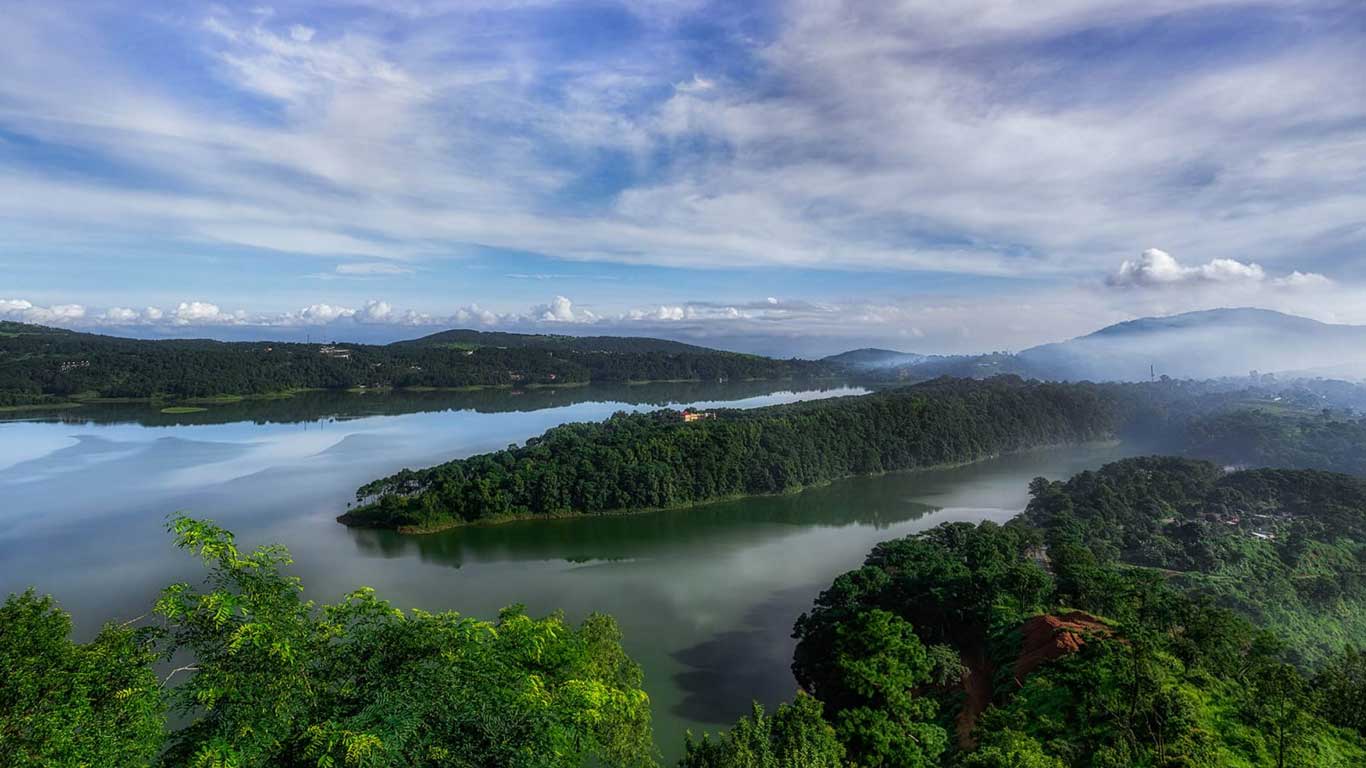
You will cross your first lake even before you reach Shillong. Umiam Lake, aka Barapani, lies 16 km before Shillong on NH40. Umiam in Khasi means ‘water of the eyes’. The lake is the source of the Umiam River, which has been dammed into a reservoir to produce electricity. Rikynjai is a plush spa resort on the banks of the lake. Orchid Lake Resort also offers a stay near the lake, with water sports facilities such as speed boating, water-skiing and rowing. The hills and the meadow around the lake are lovely.
Also, check out the horseshoe-shaped Ward Lake right in the middle of the town. Surrounded by green meadows and colourful flowerbeds, the lake makes for a good picnic spot.
Waterfalls
Waterfalls spread all over Shillong are another major attraction. Spread Eagle Falls near the Polo Grounds looks like an eagle with its wings spread out. Beadon and Bishop Falls, 2 km from Bara Bazaar, are twin falls. Elephant Falls, on the outskirts of Upper Shillong, is particularly beautiful during the rains.
Golfing
For, the avid golfer, a stay at the Shillong Golf Club (Tel: 0364-2223071), situated in Golf Links in the Polo Grounds, with temporary membership, will provide an opportunity to test the famed course. Known as the ‘Gleneagle of the East’, it has been around since 1924. It’s an extraordinary beautiful 18-hole course lined with fragrant pine and flowering rhododendron trees.
Shillong Peak
Shillong Peak, at a height of about 6,433 ft, offers a wonderful view of the city and countryside, broken intermittently by drifting clouds. On a clear day, one can see the Eastern Himalaya, including Gorichen (22,000 ft), the highest peak in Arunachal Pradesh.
Museums
The State Museum, not particularly exciting, displays the lifestyle of the Khasis with life-sized statues. The Butterfly Museum and the Botanical Survey of India Orchidarium have impressive collections.
Around Shillong
Smit (15km)
Five kilometres off the Jowai Road, on NH44, lies smit, THE Palace of HimaKhyrim. It is here that the famous Nongkrem dance - so often depicted in tourism brochures as a Khasi dance – is held, usually every November. The place is worth a visit even if one misses the event. The dance is held in the courtyard of a house called KaIngSaad, belonging to the high priestess of a traditional Khasi house still standing.
Cherrapunjee (54km)
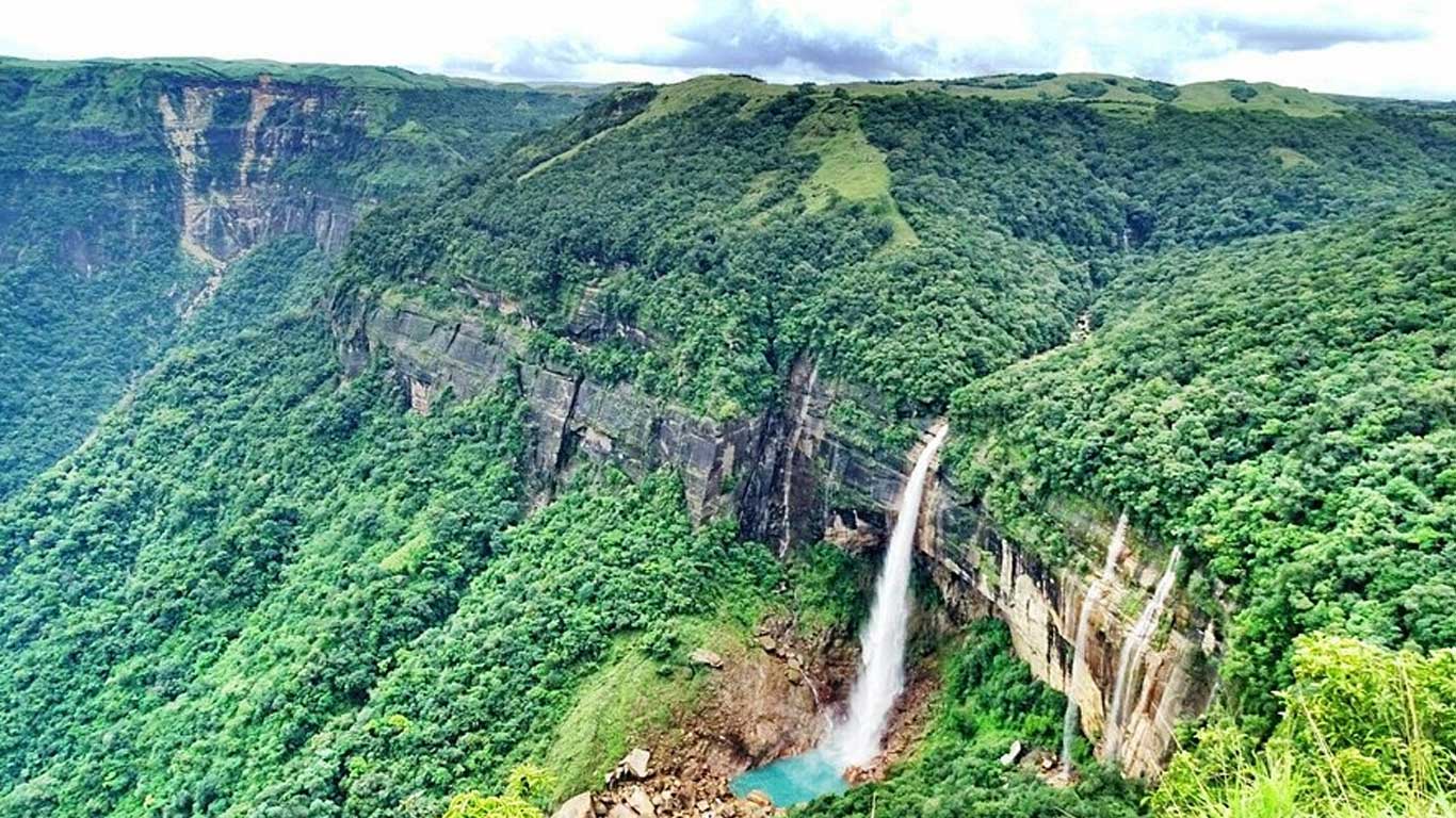
No visit to Shillong can be complete without a trip to Cherrapunjee (officially re-christened to its old name ‘Sohra’), known to every school child for receiving the highest rainfall in the world – a title now taken over by nearby Mawsynram, though. As far as rain statistics go, consider this: on June 16, 199, it rained 1,563mm in 24hours in Chrerrapunjee, while the annual average in Delhi is 611mm and in Kolkata 1,600.8mm. Chrrapunjee falls directly in the path of the south-west monsoon clouds of a wide area to a relatively small area.
The standard day-tour circuit here is: Mawsmai Caves, Viewpoint, Eco Park, Seven Sisters’ viewpoint, Thankharang Park and KhohRamhah. Mawsmai Caves are Meghalaya’s only lit-cave system open for tourists, studded with imaginative lime formations crafted over years by the slow dripping of water.
Visit the Dainthlen Falls ,the Nongsawlia Church with the distinction of being the first Christian church in this area built around the 1850s by Welsh missionaries; and Mawlong Peak which is a small hillock in Cherra Market is a local haat, held every eight days.
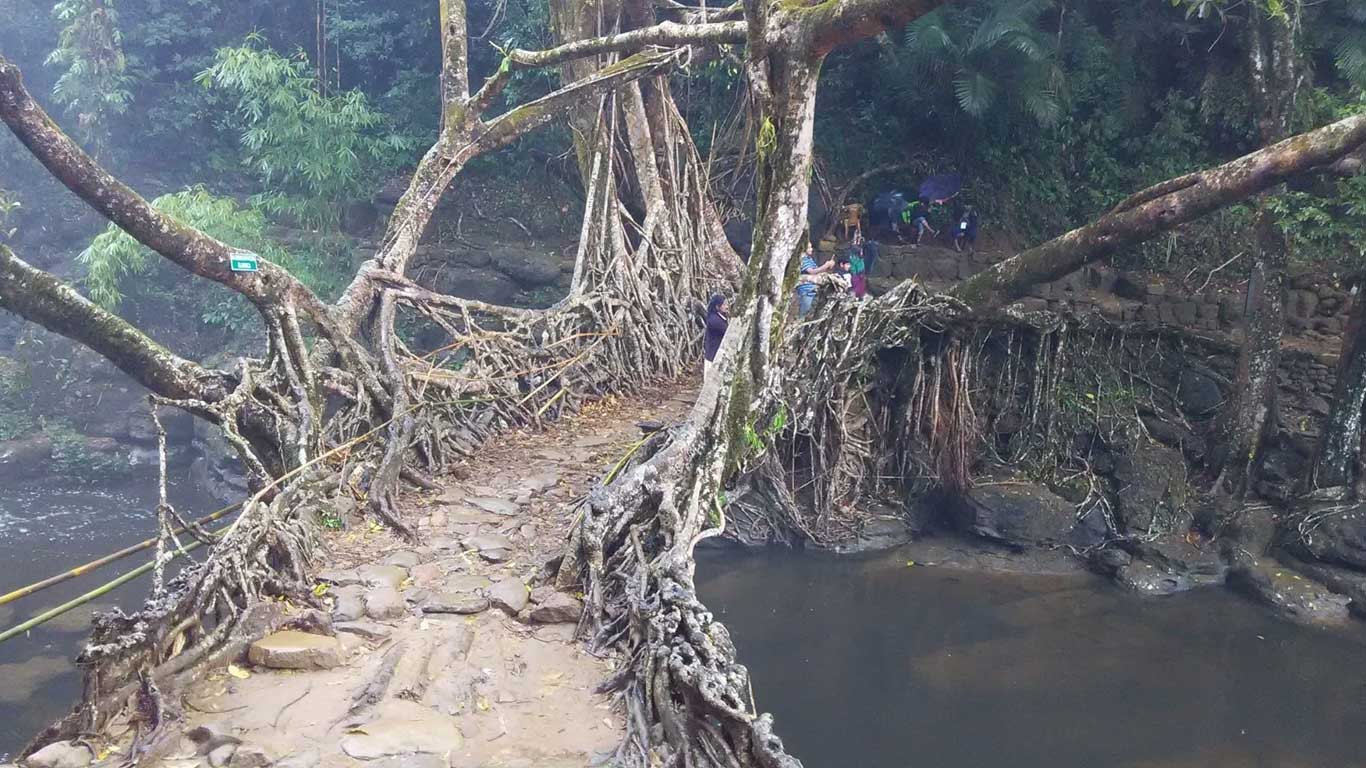
Living root bridges are unique to Meghalaya and are not to be found anywhere else in the world. A centuries old craft practiced by the War Khasis of the area, the bridge is engineered from the roots of ficus elastic, a species of the Indian rubber tree with exuberant root growths. In an ingenious feat of bio-engineering, they plant the tree along the river and direct its root vines through hollowed splits of betel nut or bamboo pipes until these bridge the stream and take root on the far bank. With a protective base and intricately woven guard railings, and roots from the higher branches as support, it’s a solid spread.
The living root bridge over Ummonoi is a 4km hike, and the more stunningUmshiang double decker root bridge at Nongriat is walk of 17km one way!
Cherrapunjee Holiday Resort (Tel: 03637-244218-20; Tarrif: Rs. 600-2,000) lies 16km from the town. It’s an excellent place to understand details about the rain, explore the area and gorge on local delicacies.
Thadlaskein Lake (56km)
Take NH44, driving through some absolutely stunning landscape. Tradition has it that the rectangular Thadlaskein Lake was dug with the help of arrowheads, but it is fed by perennial underground springs. If you start early you can even cover Nartiang, the seat of an ancient kingdom, and see a cluster of megaliths there – the Stonehenge of the Jaintia Hills, A private lodge is expected to come up here soon.
Mawlynnong (90km)
Tiny Mawlynnong is cited as the model village of Meghalaya and the ‘cleanest village in India’. Walking through the village , you’ll see well-tended garden paths, with cane basket bins placed along the way, houses with manicured garden, ivy creeping up on walls….
You can visit the living root bridge of Riwai village, a short 10min hike away. Thiep Ski village has a dexterously crafted bamboo and cane bridge over the JasharRivar. Further on are Lyndew Falls and Nairiang Falls. Dawki(20km) is the last village on the Indian side, along the Umngot River.
Humro Tours
-
Address:19 MN Sarkar Road, Mahananda para, near Sevoke More, Siliguri 734001 ,Siliguri, Darjeeling, State : West Bengal, Country : India. PIN : 734001
-
Call Us at:
+919733000592; 9733000594; 9733300676; 9733300686 -
Mail Us:
info@easthimalaya.in


